29 June
22 min read
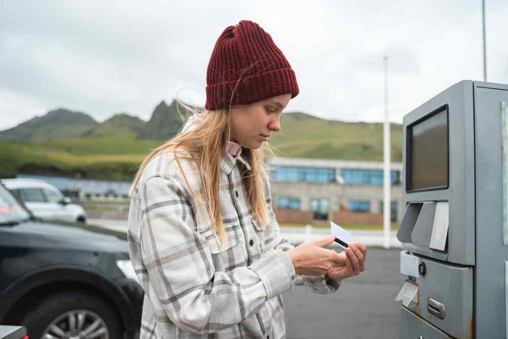
Campervan Trip in Iceland Cost: Full Budget Guide for Every Travel Style

23 February 2026
19 min read
Fourteen days in Iceland is the ideal time window to see our country. Anything shorter than that and you spend about 80% of the trip driving, checking the time, and wondering why everyone said this would be relaxing.
An itinerary for 14 days in Iceland gives you space. Space to stop. Space to wait out the weather. Space to actually leave the camper instead of eating snacks in the driver’s seat. At Campervan Reykjavik, we watch the same pattern every season.
People rush the South Coast, ignore distances, and look exhausted by day four. This route is built to avoid that. Read it properly, and you get realistic drive times, sensible overnight stops, and a Plan B for when Iceland changes its mind. It will.
This 14-day itinerary in Iceland is built for those who want to finish the trip still enjoying it, not counting the hours until the return flight. Before committing, orientation matters. The route runs clockwise, starting with the South Coast, while energy levels are high and crowds are easier to handle early. That alone fixes a lot of common mistakes.
The full loop covers roughly 1322 km (820 miles). Spread over fourteen days, that averages about 92 km per day (57 miles). Some days are shorter, some longer, but none feel punishing. You are not living behind the wheel. This route is designed specifically for camper travel.
Campsites are spaced logically, resupply towns are planned, and long, exposed stretches are broken up properly. Camping rules matter in Iceland. Wild camping is illegal for campervans. This itinerary respects that reality and plans nights at proper campsites, so you are not improvising after dark in bad weather.

When you rent a camper in Iceland through us, the vehicle choice is straightforward. This 2-week Iceland itinerary stays on paved roads and does not include F-roads, which immediately rules out a lot of unnecessary upgrades. Here’s what vehicles we recommend and why:

That’s the planning out of the way. Now comes the part you actually care about. Below is the full, day-by-day 2-week Iceland campervan route, including drive times, overnight stops, and where to slow down.
After you pick up your camper from one of our locations, either Keflavík International Airport or Reykjavík city, the trip starts immediately. Pickup and drop off are available at both, depending on your vehicle category and model. This itinerary for 14 days in Iceland begins gently, by design. Day one is about settling in.
Day 1: Golden Circle to Selfoss
We begin the day by heading out to the Golden Circle. The distance is about 190 km (118 miles) with roughly 4 hours of driving. Leave Reykjavík around 7 AM. Start at Þingvellir National Park for the tectonic plates and visitor center. Continue to Geysir for the active geothermal area and information building.
Finish with Gullfoss and both main viewpoints. Head south on Route 1 to Selfoss. Stock up at Krónan. Overnight at Selfoss Campsite. It is open year-round and offers electricity, showers, kitchen facilities, WiFi, and an easy walk to the pool and shops.

Day 2: South Coast to Skógar or Vík Area
We leave around 8 AM and keep a close eye on wind and ice conditions. Route 1 is usually plowed, but it can still be slick, especially in exposed sections.
The first stops are Seljalandsfoss and nearby Gljúfrabúi. If conditions are calm, continue to Skógafoss and decide on the stairs based on the wind. In the afternoon, head toward Reynisfjara Black Sand Beach and stay strictly on marked paths.
Dyrhólaey is optional and only worth it if visibility is good. Overnight at Skógar Campsite, or divert inland to Hella if coastal winds pick up.
Day 3: Vík Exploration and Weather Buffer
This day is intentionally light. Start in Vík village to refuel and restock groceries at Krónan, then slow the pace down properly. If conditions allow, walk the coastline toward Víkurfjara for views back toward the village and the cliffs. Head up to the hilltop church for shelter and perspective, especially if the wind is active.
Use the local cafés, swimming pool, and facilities to reset after two full driving days. This is also a good point to reorganize the camper, do laundry, and take stock of the forecast ahead.
Use the rest of the day as a buffer for storms, road closures, or simple recovery time. If the weather turns, staying put is the right decision, and Vík is one of the easiest places on the South Coast to wait it out without feeling stranded.
Overnight at Vík Camping, opening mid-April 2026, with electricity for 36 vans, showers, waste facilities, and WiFi. If Vík Camping is not open yet, backtrack about 25 km (16 miles) to Skógar Campsite.

Day 4 marks a clear shift in this Iceland ring road itinerary for 14 days. You leave behind black sand beaches and waterfalls and drive straight into glacier country. After passing mossy lava fields, the landscape tightens around Vatnajökull and its glacier tongues.
If conditions allow, consider a mid-morning stop at Fjaðrárgljúfur before you reach Vatnajökull. Otherwise, keep moving. In Skaftafell, prioritize short hikes like Svartifoss or stay near the visitor center if wind or rain picks up.
Aim for Jökulsárlón Glacier Lagoon later in the afternoon for calmer light and fewer crowds. Overnight at Skaftafell Campsite, a practical year-round base with electricity, showers, and easy access to both glacier hikes, Jökulsárlón, and Diamond Beach the following morning.

Days 5 and 6 cover the Eastfjords, which stretch from the Skaftafell and Jökulsárlón area to Egilsstaðir. This part of the 2-week Iceland itinerary is slow by nature and should stay that way. Route 1 winds tightly along the coastline, with sharp curves and short sightlines. Expect to drive 40-60 km/h (25-37 mph) in many sections.
The weather changes fast here. Fog, wind, and snow can roll in over higher sections, especially near mountain passes. Check Umferdin.is before committing to detours and stick to the main road if conditions look unstable. Fuel and food options are limited, so top up before leaving the south. Djúpivogur has basic supplies, but nothing runs late.
Overnight on Day 5 at Breiðdalsvík Campsite or Fáskrúðsfjörður Campsite, both small and quiet. On Day 6, continue to Egilsstaðir Campsite, which is open year-round and ideal for resupply before heading north.
Day 7 is where this 14-day route in Iceland route changes character. You leave the last real services behind in Egilsstaðir and head north on Route 1. Fuel up before you go. There is nothing reliable after that until Mývatn. The drive is straightforward, but the scenery turns quickly. Fjords fade out while lava fields move in, and steam starts leaking out of the ground.
Stop at Hverir if conditions are clear. Boiling mud, sulfur deposits, and constant steam make it obvious you are crossing into Iceland’s rift zone. Stay on marked paths. The ground here is unstable and hot enough to hurt you fast. The smell is strong and unavoidable.
By the time you reach the lake, slow down. Walk the shoreline, then decide if you have the energy for Mývatn Nature Baths. Overnight at Hlíð Campsite, well placed for a clean start tomorrow.

Day 8 digs into the raw side of North Iceland and fits cleanly into a 2-week stay in Iceland without pushing daylight too far. Start near Lake Mývatn and move slowly. If Dettifoss is on your list, only attempt it via the west side on Route 862 and only if Umferdin.is shows clear conditions. Even though it is paved, snow and ice make it unreliable from January through April. If the status reads ‘not known,’ skip it.
Continue toward Godafoss, then head north to Húsavík. This is where you should slow down and commit to the classic 3-hour whale watching tour from the harbor. Tours typically run between early afternoon and late afternoon and are weather dependent, but when they go out, they deliver. Húsavík sits on one of the best feeding grounds in the country.
Húsavík is windy and exposed, especially near the harbor, so park early and secure the camper properly. Overnight at Húsavík Campsite, with electricity, showers, fuel nearby, and walking access to the harbor.
Days 9 and 10 leave the Ring Road behind and slow things down properly. Tröllaskagi is narrower, steeper, and quieter than anything you have driven so far. Route 76 hugs the coastline with sharp bends, short tunnels, and one-lane bridges. Expect speeds of 30-50 km/h (19-31 mph) and plan to use pullouts often. The road is suitable for campervans, but only if you stay alert.
Wind is the main variable here. Gusts funnel through the fjords and exposed ridges. If Vedur.is shows strong winds above 25 m/s (56 mph), then stay closer to Siglufjörður or Ólafsfjörður and avoid long coastal pushes. If conditions worsen, turn back toward Varmahlíð and rejoin Route 1 instead of forcing it.
Villages are quiet and functional, with minimal traffic and good shelter. Overnight at Siglufjörður Campsite, open year-round with electricity, showers, and a sheltered harbor setting.

Day 11 is a positioning day in this itinerary for 14 days in Iceland. You are not chasing highlights. You are setting up the Snaefellsnes Peninsula without arriving tired or late. Leave Tröllaskagi and follow Route 1 inland toward Blönduós. The road is straightforward but repetitive, which is where fatigue sneaks in.
Split the drive at Hvammstangi after roughly 140 km (87 miles). Grab fuel, coffee, and reset before continuing. Instead of committing to weather-dependent boat trips, stop at the Icelandic Seal Center. It gives proper context on seal colonies along this coast and works regardless of wind or visibility.
This is a smarter stop on a transit day. Services thin out quickly, so the N1 station in Blönduós is non-negotiable for fuel and groceries. Overnight at Grundarfjörður Campsite for a strong start tomorrow, or Borgarnes Campsite if you want a shorter day with year-round facilities.
Days 12 and 13 cover Snaefellsnes properly, without trying to cram it into one long day. This stretch of your 2-week Iceland itinerary works best as a full anti-clockwise loop. Start from Grundarfjörður around 8 AM and head to Kirkjufell Mountain early, before traffic and tour buses stack up.
Continue south through Arnarstapi and Hellnar, focusing on short stops. Most sights here only require 15-30 minutes outside in the wind and cold, which is exactly what you want. As you round the peninsula, pass through Hellissandur and Ólafsvík. These are practical stops for fuel and supplies, and the roads on this side are usually calmer.
Wind along the cliffs often reaches 30-50 km/h (19-31 mph), so adjust plans if Vedur.is flags warnings. Because campsite options here are seasonal, return to Grundarfjörður Campsite for the night. It is one of the few reliable, year-round campsites on the peninsula and keeps the next day simple and flexible.

Day 14 is about finishing clean, not squeezing in one last big drive. Plan the return to Reykjavík with time to spare and keep an eye on Umferdin.is for weather or traffic delays. If conditions are calm and your schedule allows, go for a final dip at the Secret Lagoon for a final reset. Do not overcommit. This is still a travel day.
Before dropping off, handle the basics properly. Clean the interior, including kitchenware, remove all trash, refill the fuel tank, and make sure the battery is charged. Fill the clean water tank, empty the gray water tank, and rinse the exterior if needed so staff can inspect the vehicle.
Check every cupboard and bag for personal items. Refill the gas bottle if applicable. Same-day flights are a bad idea. Delays happen. If you have extra time, a Reykjavík food walk tour fits well after drop off and does not depend on the weather.
This 2-week Iceland itinerary changes with the season. Daylight, road access, crowds, and weather all dictate how hard you can push and where you should not.

While driving in Iceland during winter is already tricky, that is only the first reality check. Short daylight, wind, and ice demand more attention than most people expect. On top of that, a full 14-day Ring Road plan adds layers of risk that need to be understood before you commit.
What to factor in:

These apps are not optional for 14 days in Iceland. They exist to stop stupid problems before they start. Signal drops. Campsites close. Road statuses change without warning. If you rely on memory or luck, you will lose time or money.
Signal disappears fast in fjords and remote areas, so one app is not enough.
Wild camping fines run around 50,000 ISK. Guessing is expensive.

Cold drains batteries fast.
Practical campervan tips are what keep this 2-week Iceland itinerary from unraveling halfway through. This is about logistics, not vibes. Fuel gaps, resupply timing, facilities, and wind exposure will decide how easy the trip feels.
Refill early and refill often. Treat half a tank as empty. Plan fuel stops in Reykjavík and Selfoss on Day 1, Vík on Day 3, Skaftafell on Day 4, Egilsstaðir on Day 5, Mývatn on Day 7, and Akureyri on Day 8. The Eastfjords stretch 150 km (93 miles) without reliable stations, and the Blönduós N1 on Day 11 is non-negotiable. Expect 20 to 25 percent higher consumption in headwinds. Diesel pumps are green.
Do a full shop in Reykjavík for 3 to 4 days. Restock in Vík, Egilsstaðir, and Akureyri. Smaller coastal villages like Breiðdalsvík, Ólafsfjörður, and Hellissandur have limited stock and higher prices. Use campsite kitchens where possible and freeze extra protein for the Eastfjords.
Most campsites charge 500 to 1,000 ISK for hot showers and about 1,000 ISK for electricity. Reliable year-round facilities are found in Selfoss, Skaftafell, Egilsstaðir, Siglufjörður, and Grundarfjörður. Public pools in Egilsstaðir and Húsavík are dependable for a proper reset.
Always park nose into the wind. Check the wind direction before committing. Avoid exposed coastal campsites near Reynisfjara, Arnarstapi, and Húsavík harbor during strong forecasts. Choose more sheltered locations like Skógar, Siglufjörður, or Grundarfjörður when conditions deteriorate.

The table below shows an estimated price range for two people following this itinerary. These prices may vary depending on the season.
|
Category |
Low End (USD) |
High End (USD) |
|
Rental + Insurance |
1,120 |
1,680 |
|
Fuel |
625 |
625 |
|
Campsites |
390 |
650 |
|
Food |
1,220 |
1,780 |
|
Activities |
360 |
360 |
|
Miscellaneous |
180 |
180 |
|
Total (2 people) |
3,895 |
5,275 |
Daylight controls everything. Winter gives 4-9 hours. Distances are driven slower than expected. Build buffer days, or the weather will break your plan.
February is usually cheapest. Flights and rentals drop 20-40% versus summer, but daylight is limited to 8-9 hours, and storms are common.
Late December to early January. Prices peak, daylight drops to 4-5 hours, and frequent storms and closures restrict travel.
Yes. Over 90% of Icelanders speak fluent English. Communication is easy across towns, tours, and campsites.
Yes, but reserved. They are direct and helpful, not chatty. Respect rules and personal space, and interactions stay positive.
More Iceland Stories to Explore
Discover more tips and tales to fuel your next saga
Join thousands who have booked with us
Iceland's most booked campervan of 2025 is waiting. Secure yours today!
Your rental comes with:
Handy Extras
Essential Insurance Plan
Unlimited Mileage
Flexible Cancellation