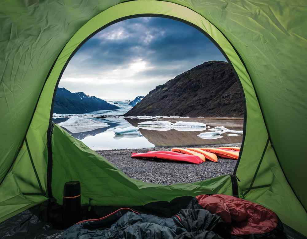
22 June
11 min read
Iceland Gas Card: Do You Need One, or Is a Credit Card With PIN Enough?
2 March 2026
11 min read
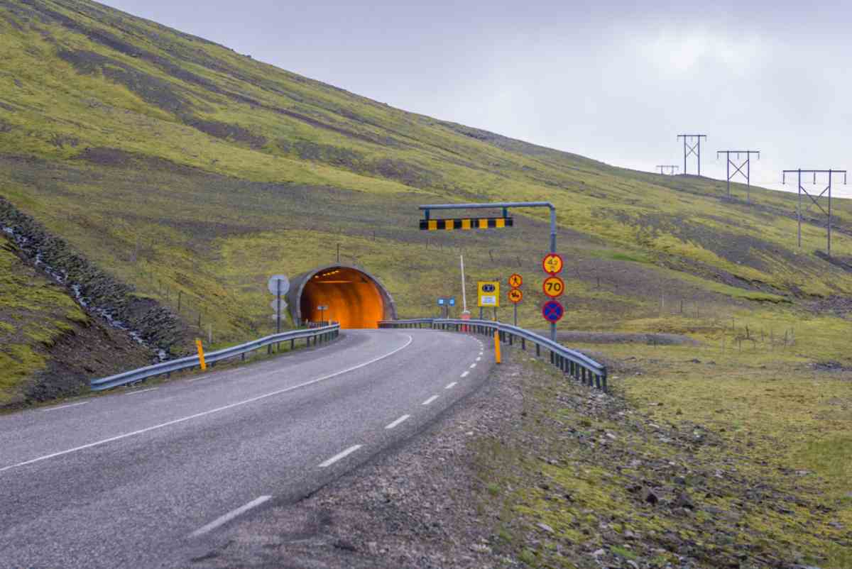
The tunnels in Iceland slice straight through cliffs, under fjords, and beneath sketchy mountain passes. They’re not scenic. They’re practical. You’ll use them without thinking, especially on the Ring Road and anywhere near the Westfjords.
Some are short. Some stretch for kilometers. A few will test your patience if you’re not used to one-lane traffic. This guide breaks down the main road tunnels in Iceland, where to find them, and what to expect.
If you're renting a campervan in Iceland, knowing what’s ahead saves time and avoids stupid detours.
Use the map below to locate each tunnel along your planned route. It helps you spot potential bottlenecks, one-lane sections, or detours in advance. It’s especially useful for timing stops or avoiding surprises mid-drive.

Héðinsfjarðargöng is Iceland’s tunnel system with the greatest total length, located on Road 76 in the Tröllaskagi Peninsula. It links Ólafsfjörður and Siglufjörður north of Akureyri, cutting through Héðinsfjörður fjord.
Two lanes throughout, one in each direction. Opened in 2010.
Improves year-round access between two remote towns. Safer, faster, and more reliable than the old mountain road. Critical for local traffic and anyone driving the north coast loop from Akureyri.
No need to yield. The tunnel is well-lit and monitored by speed cameras. Obey posted limits even if it feels empty. Check conditions on umferdin.is in winter. Closures are rare but possible.

This tunnel in Iceland cuts through the Westfjords and links Ísafjörður, Suðureyri, and Flateyri. Routes 60 and 65 meet underground. Yes, it’s an actual junction in a mountain.
Most of the tunnel is single-lane with right-of-way signage. Opened in 1996.
This tunnel in Iceland made winter isolation a thing of the past. It connects communities, supports tourism, and keeps emergency access open through avalanche season.
Yield if the passing bay is on your side. Speed limit ranges from 50 to 70 km/h. Well-lit but lacks ventilation. There is also no toll. Just watch for cameras. In winter, slow down and stay alert.

This tunnel island fix lies in the Westfjords, north of Ísafjörður, along Route 61. It bypasses the avalanche-prone coastal stretch at Óshlíð between Ísafjörður and Bolungarvík.
Opened September 25, 2010, with 3.7 kilometers (2.3 miles) of new road and bridges built alongside it.

The old route was sketchy even on a good day. This tunnel replaces it entirely, cutting risk and travel time between the region’s two busiest towns.
No yielding needed. Stick to posted limits. Lights on, even during daylight. Cameras are active. Open all year, but always check umferdin.is before heading north.
Located on Route 61 in northwest Iceland’s Westfjords, between Skutulsfjörður and Álftafjörður. Sits just outside Ísafjörður and links toward Súðavík through steep coastal terrain.
This is where the tunnels in Iceland began. Opened in 1948, it was the country’s first manmade road tunnel and helped connect isolated fjord communities long before modern infrastructure reached this region.
Two lanes. No yielding. Just keep moving. Open year-round and barely worth worrying about.

Located on Route 76 in northern Iceland’s Tröllaskagi Peninsula, just north of Siglufjörður. Part of the original route linking northern fjords to Akureyri. Still used on some scenic detours today. It was built in 1967 and is Iceland’s second road tunnel.
This tunnel kept Siglufjörður connected before longer tunnels existed. It replaced winter boat trips, opened up trade routes, and still plays a backup role in the broader Akureyri tunnel network.
Northbound has the right of way. If you're heading south, pull into marked bays. Stay slow, especially in bad weather. No tolls

Located on Route 82 in North Iceland, between Dalvík and Ólafsfjörður. Built in 1991 as part of the Tröllaskagi coastal loop north of Akureyri, replacing high-risk mountain routes.
Múlagöng provided the first all-season land access between these fjord towns. It improved travel times, reduced isolation, and kept Arctic coastal routes moving through winter.
Southbound traffic has the right of way. Northbound drivers must pull into marked recesses. Keep speed between 30 and 50 km/h. Slow for blind curves. Watch conditions in winter.

Located just east of Akureyri on Route 1, between Eyjafjörður and Fnjóskadalur valley. Built in 2018 to bypass the dangerous Víkurskarð mountain road. This Akureyri tunnel is a key link between Akureyri and destinations like Húsavík and Mývatn.
Cuts 16 kilometers (9.9 miles) off the Ring Road and saves up to 12 minutes. Improves safety and year-round access in a region often hit by winter closures.
No yielding. Toll must be paid online at veggjald.is within 24 hours. Rental companies may charge handling fees if you miss it. The speed limit is 70 to 90 km/h. Cameras are active.

Opened in 1998, this tunnel near Reykjavík runs beneath Hvalfjörður fjord on Route 1. It connects the capital area to Borgarnes and the Snæfellsnes Peninsula, replacing the old 45-kilometer fjord loop with a direct undersea route.
The Hvalfjörður tunnel toll was discontinued in 2018 after management shifted to the Icelandic Road Administration. It cut Ring Road travel time by nearly an hour. Still handles over 5,000 vehicles daily.
There are over 80 active cameras in this tunnel near Reykjavík. Speed limits range from 70 to 90 km/h. Lay-bys are for emergencies only. FM radio and mobile coverage are available throughout.
Safety features include emergency phones and extinguishers every 125 meters (410 feet), ceiling lights every 50 meters (164 feet), backup lighting every 62.5 meters (205 feet), and 40 fans for ventilation.

Located in East Iceland along old Route 92, between Eskifjörður and Norðfjörður in Fjarðabyggð municipality. Built in 1977, the tunnel sits at roughly 600 meters (1,969 feet) elevation, bypassing the high Oddsskarð pass and connecting fjord towns once cut off in winter.
Once one of the most weather-prone tunnels in Iceland, it kept Eastfjords villages moving until its closure. Now used mainly for ski access.
Closed to through traffic. Ski area access is only in winter. Use the replacement tunnel on Route 92. Single-lane rules apply. Conditions vary. So, always check umferdin.is. 4WD and chains are recommended from November through April.

Opened in 2017, this is Iceland’s tunnel solution for safer access to Neskaupstaður. Found on Route 92 in East Iceland’s Fjarðabyggð region, it bypasses the steep Oddsskarð pass and the outdated Oddsskarðsgöng. Runs northwest of Eskifjörður through the highlands.
This tunnel replaced the most closure-prone section of Route 92. It keeps Eastfjords residents and freight moving year-round, without relying on mountain weather.
No yielding needed. Lit throughout with a 1.5 to 3 percent incline. No toll.

Opened in 2005, this tunnel sits on Route 1 in East Iceland’s Fjarðabyggð municipality. It connects Fáskrúðsfjörður in the south to Reyðarfjörður in the north. Part of the Ring Road circuit through the East Fjords.
Cuts out old coastal and mountain roads prone to ice, fog, and closures. Keeps Route 1 open year-round. Supports local traffic, tourism, freight, and industrial access in the East.
Two-lane tunnel with consistent flow. The speed limit is 70 to 90 km/h. Monitored by cameras.

Opened in 2005, this Ring Road tunnel sits east of Höfn in southeast Iceland. Found in Hornafjörður municipality, it links the coast to the Lón district and completes the southeastern Ring Road section.
Replaced one of the most weather-prone mountain passes used before modern tunnels in Iceland. Keeps Route 1 moving through winter and cuts out major delays.
Two-lane tunnel with no yielding. Speed limits range from 70 to 80 km/h. Cameras in place. The old pass is still open in summer for sightseeing.

Skip Vaðlaheiði by using roads 84 and 83. From the east, turn north 2 km before the tunnel. Do not take Road 835 by mistake. It’s free.
No. Most tunnels in Iceland are free. Only the Vaðlaheiði tunnel near Akureyri charges a toll. All others are publicly maintained with no fee.
Yes. Hvalfjarðargöng is Iceland’s only sub-sea road tunnel. It runs beneath Hvalfjörður fjord and reaches a depth of 165 meters (541 feet) below sea level.
For vehicles under 3.5 tons, it costs 2,152 ISK one way or 4,304 ISK round trip. Pay online at veggjald.is before or after driving through.
Only the Vaðlaheiði tunnel requires payment. It is Iceland’s sole toll tunnel. All other tunnels across the country, including older and longer ones, are free of charge.
More Iceland Stories to Explore
Discover more tips and tales to fuel your next saga
Join thousands who have booked with us
Iceland's most booked campervan of 2025 is waiting. Secure yours today!
Your rental comes with:
Handy Extras
Essential Insurance Plan
Unlimited Mileage
Flexible Cancellation